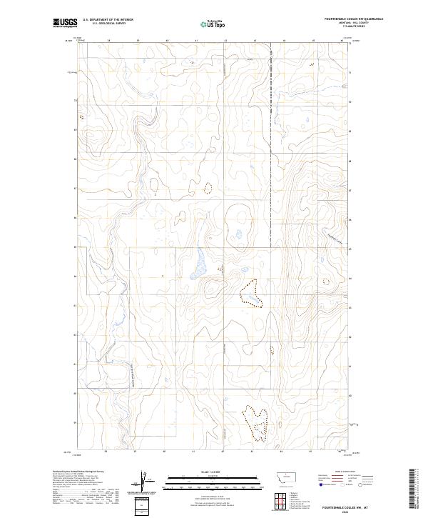
2024 Map of Fourteenmile Coulee NW
USGS Topo · Published 2024About this map
East Fork Black Coulee carves a winding path through this portion of Hill County, defining the drainage patterns of a landscape marked by intermittent wetlands and gentle elevation changes. The terrain is characterized by the distinct glacial coulees common to the Montana plains, with Faulkners Coulee providing notable relief in the eastern section. This 2024 data represents a modern topographical record of the High Line region, where the Public Land Survey System grid remains the dominant organizing force for human activity. Local transport is facilitated by rural arteries such as Hingham Rd and Rd 40 S, which follow section lines across several townships, including T31N R10E and T32N R10E. The map detail highlights the sparse settlement patterns and the persistence of traditional land divisions in this agricultural frontier.
Find a feature on this map
10 named features on this map. Tap any name to fly to it.
Don’t see what you’re looking for? This feature index may not catch every label — zoom into the map to look around manually.
Map Details
Editions of this 2024 Fourteenmile Coulee NW Map
This is the sole edition of this map. No revisions or reprints were ever made.
Other maps of this area

1919 · Big Sandy
USGS Topo · 1:125,000

1919 · Alma
USGS Topo · 1:125,000

1920 · Gildford
USGS Topo · 1:125,000

1943 · Gildford
USGS Topo · 1:125,000

1954 · Shelby
USGS Topo · 1:250,000

1958 · Shelby
USGS Topo · 1:250,000

1969 · Fourteenmile Coulee SW
USGS Topo · 1:24,000

1969 · Hingham
USGS Topo · 1:24,000

1969 · Fourteenmile Coulee NW
USGS Topo · 1:24,000
1969 · Fourteenmile Coulee SE
USGS Topo · 1:24,000