
1969 Map of Fourteenmile Coulee NW
USGS Topo · Published 1972About this map
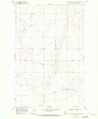
The East Fork Black Coulee carves through this northern Montana landscape, revealing a section of the Missouri River Basin development area during the late 1960s. The terrain is defined by the drainage patterns of Faulkners Coulee and a distinctive landform simply labeled Box. This map reflects the mid-century agricultural and infrastructure layout of Hill County, characterized by a grid of section lines and range boundaries like R. 9 E. R. 10 E. A lone Landing Strip sits in the southern portion of the quadrangle, suggesting the reliance on small-aircraft transportation for ranching or surveying in this expansive region. The absence of concentrated town centers highlights the rural, decentralized nature of the high plains at this time.
Find a feature on this map
7 named features on this map. Tap any name to fly to it.
Don’t see what you’re looking for? This feature index may not catch every label — zoom into the map to look around manually.
Map Details
Editions of this 1969 Fourteenmile Coulee NW Map
This is the sole edition of this map. No revisions or reprints were ever made.
Other maps of this area

1919 · Big Sandy
USGS Topo · 1:125,000

1919 · Alma
USGS Topo · 1:125,000

1920 · Gildford
USGS Topo · 1:125,000

1943 · Gildford
USGS Topo · 1:125,000

1954 · Shelby
USGS Topo · 1:250,000

1958 · Shelby
USGS Topo · 1:250,000

1969 · Fourteenmile Coulee SW
USGS Topo · 1:24,000

1969 · Hingham
USGS Topo · 1:24,000
1969 · Fourteenmile Coulee SE
USGS Topo · 1:24,000
1969 · Fourteenmile Coulee NE
USGS Topo · 1:24,000