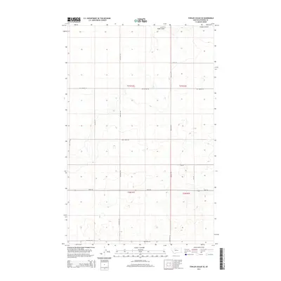
2014 Map of Fowler Coulee SE
USGS Topo · Published 2014About this map
Pondera Coulee and Rocky Coulee carve through this section of the northern Montana plains, defining the topography of an area dominated by large-scale agricultural blocks. The landscape is organized by a strict grid of section lines and gravel roads, including Hog Johnson Rd and Preputin Rd, which reflect the region's enduring homesteading and ranching heritage. This 2014 survey shows a rural infrastructure where infrastructure like Substation Rd supports the expansive grain and livestock operations typical of Pondera County. Local family-named routes such as Kathan Rd, Bitz Rd, and Armstrong Rd serve as vital connectors between isolated homesteads and larger regional arteries like Brady Rd, documenting the contemporary rural road network and the persistent geography of the high plains.
Find a feature on this map
19 named features on this map. Tap any name to fly to it.
Don’t see what you’re looking for? This feature index may not catch every label — zoom into the map to look around manually.
Map Details
Editions of this 2014 Fowler Coulee SE Map
This is the sole edition of this map. No revisions or reprints were ever made.
Other maps of this area

1886 · Great Falls
USGS Topo · 1:250,000

1920 · Conrad
USGS Topo · 1:125,000

1949 · Timber Coulee
USGS Topo · 1:62,500

1950 · Timber Coulee
USGS Topo · 1:62,500

1950 · Dutton
USGS Topo · 1:62,500

1954 · Great Falls
USGS Topo · 1:250,000

1954 · Shelby
USGS Topo · 1:250,000

1957 · Great Falls
USGS Topo · 1:250,000

1958 · Shelby
USGS Topo · 1:250,000

1967 · Fowler Coulee SW
USGS Topo · 1:24,000