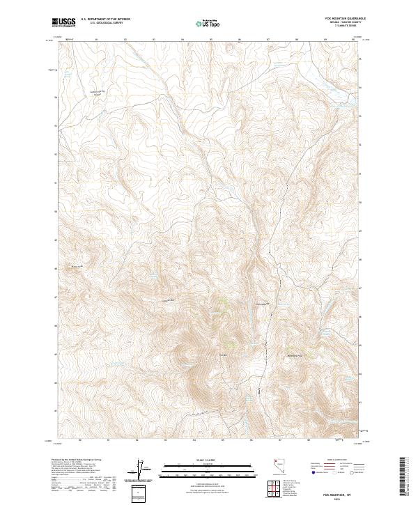
2021 Map of Fox Mountain
USGS Topo · Published 2021About this map
Granite Range dominates this corner of Washoe County, where high ridges and deep canyons define the landscape. The terrain is marked by prominent summits such as Fox Mtn and Mahogany Peak, with water sources like Potato Patch Spring and Ferdalin Spring providing critical points of interest in an otherwise arid environment. The presence of Grass Valley Reservoir in the northeast and the winding course of Cottonwood Cr suggest a landscape managed for water resources. Human movement through this topography is anchored by Old Camp Canyon Rd, which skirts the southern slopes near No Savvy Cr. This 2021 survey illustrates a region where names like Mahogany Troughs and Summit Spring Canyon reflect the localized landmarks used by ranchers and outdoorsmen navigating the Great Basin.
Find a feature on this map
31 named features on this map. Tap any name to fly to it.
Don’t see what you’re looking for? This feature index may not catch every label — zoom into the map to look around manually.
Map Details
Editions of this 2021 Fox Mountain Map
This is the sole edition of this map. No revisions or reprints were ever made.
Other maps of this area

1886 · Granite Range
USGS Topo · 1:250,000

1889 · Long Valley
USGS Topo · 1:250,000

1894 · Granite Range
USGS Topo · 1:250,000

1954 · Vya
USGS Topo · 1:250,000

1955 · Lovelock
USGS Topo · 1:250,000

1958 · Vya
USGS Topo · 1:250,000

1959 · Lovelock
USGS Topo · 1:250,000

1962 · Vya
USGS Topo · 1:250,000

1979 · Butte Spring
USGS Topo · 1:24,000
1979 · Chester Lyons Spring
USGS Topo · 1:24,000