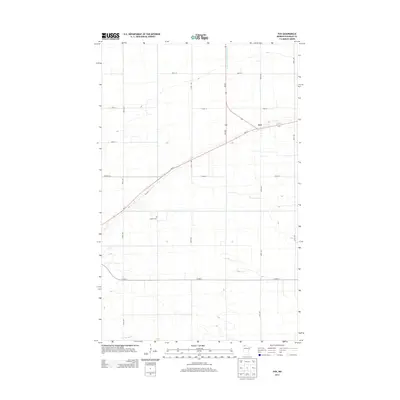
2013 Map of Fox
USGS Topo · Published 2013About this map
The small community of Fox serves as the focal point of this Northwest Minnesota landscape, situated at the junction of Mn-11 and Mn-89. The terrain is defined by a strictly organized grid of agricultural roads, including 320th St and 310th Ave, which slice across the flat expanses of Roseau County. This 2013 survey illustrates the modernization of early transport routes, where the diagonal path of Old Hwy 11 still traces a historical alignment parallel to the contemporary highway. Water management is a critical feature of the local topography, evidenced by the channelized flow of County Ditch Number Sixteen and the natural meandering of the S Br Two Rivers in the south. For those researching local heritage, the Opdahl Cem remains a significant landmark within this rural layout.
Find a feature on this map
18 named features on this map. Tap any name to fly to it.
Don’t see what you’re looking for? This feature index may not catch every label — zoom into the map to look around manually.
Map Details
Editions of this 2013 Fox Map
This is the sole edition of this map. No revisions or reprints were ever made.
Other maps of this area

1918 · Roseau
USGS Topo · 1:62,500

1918 · Garland
USGS Topo · 1:62,500

1918 · Greenbush
USGS Topo · 1:62,500

1919 · Badger
USGS Topo · 1:62,500

1952 · Thief River Falls
USGS Topo · 1:250,000

1954 · Roseau
USGS Topo · 1:250,000

1956 · Thief River Falls
USGS Topo · 1:250,000

1957 · Roseau
USGS Topo · 1:250,000

1957 · Thief River Falls
USGS Topo · 1:250,000

1958 · Roseau
USGS Topo · 1:250,000