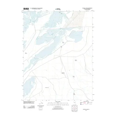
2011 Map of Foxtail Lake
USGS Topo · Published 2011About this map
Stillwater Point sits at the southern edge of a complex network of wetlands and seasonal basins in Nevada's Great Basin. This 2011 survey details a hydrological landscape where water levels dictate the geography, from the larger Foxtail Lake and Stillwater Point Reservoir to numerous smaller ponds like Pappis Pond and Dog Head Pond. The northern half of the region is defined by these shallow water bodies and landings, such as Rice Landing and Goose Landing, suggesting a history of seasonal access for ranching or waterfowl management. To the south, the terrain shifts into a series of drainages, including Shirttail Canyon and Mountain Well Canyon, which cut through the arid landscape toward the marshy flats. The presence of the East Pasture Corral and names like West Pasture reflect the area's continued use for livestock within this unique desert-and-water environment.
Find a feature on this map
31 named features on this map. Tap any name to fly to it.
Don’t see what you’re looking for? This feature index may not catch every label — zoom into the map to look around manually.
Map Details
Editions of this 2011 Foxtail Lake Map
This is the sole edition of this map. No revisions or reprints were ever made.
Other maps of this area

1908 · Carson Sink
USGS Topo · 1:250,000

1910 · Carson Sink
USGS Topo · 1:250,000

1950 · Stillwater
USGS Topo · 1:62,500

1951 · Carson Lake
USGS Topo · 1:62,500

1957 · Reno
USGS Topo · 1:250,000

1959 · Reno
USGS Topo · 1:250,000

1960 · Reno
USGS Topo · 1:250,000

1969 · Cox Canyon
USGS Topo · 1:24,000

1969 · Table Mtn
USGS Topo · 1:24,000

1969 · Pintail Bay
USGS Topo · 1:24,000