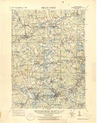
1918 Map of Framingham
USGS Topo · Published 1918About this map
The Mass. State Muster Grounds and the State Prison anchor the industrial and institutional landscape of this 1918 military tactical map. A dense network of rail lines, including the Fitchburg Railroad and the Boston and Albany Railroad, crisscrosses the terrain, illustrating the region's importance as a transportation hub during the early twentieth century. These corridors connect established centers like Concord and Natick with smaller village clusters such as Nine Acre Corner and Westvale.
Find a feature on this map
172 named features on this map. Tap any name to fly to it.
Don’t see what you’re looking for? This feature index may not catch every label — zoom into the map to look around manually.
Map Details
Editions of this 1918 Framingham Map
2 editions found
Other maps of this area

1886 · Lawrence
USGS Topo · 1:62,500

1886 · Blackstone
USGS Topo · 1:62,500

1886 · Dedham
USGS Topo · 1:62,500

1886 · Lowell
USGS Topo · 1:62,500

1886 · Framingham
USGS Topo · 1:62,500

1887 · Franklin
USGS Topo · 1:62,500

1887 · Marlboro
USGS Topo · 1:62,500

1888 · Lawrence
USGS Topo · 1:62,500

1889 · Marlboro
USGS Topo · 1:62,500

1889 · Blackstone
USGS Topo · 1:62,500