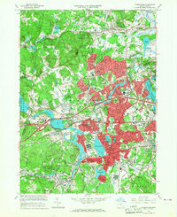
1965 Map of Framingham
USGS Topo · Published 1967About this map
Framingham serves as the bustling core of this mid-1960s survey, showing a landscape defined by significant infrastructure and institutional expansion. The arrival of the Massachusetts Turnpike and the persistence of multiple rail lines, including the New York Central Railroad and the Boston and Maine Railroad, highlight the area's role as a major transportation corridor. Beyond the transit networks, the map reveals a dense concentration of civic and social history, from the grounds of Framingham State College to the State Hospital and the National Guard Arsenal.
Find a feature on this map
105 named features on this map. Tap any name to fly to it.
Don’t see what you’re looking for? This feature index may not catch every label — zoom into the map to look around manually.
Map Details
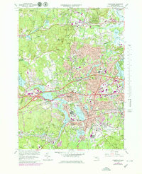
Editions of this 1965 Framingham Map
2 editions found
Other maps of this area

1886 · Blackstone
USGS Topo · 1:62,500

1886 · Framingham
USGS Topo · 1:62,500

1887 · Franklin
USGS Topo · 1:62,500

1887 · Marlboro
USGS Topo · 1:62,500

1889 · Marlboro
USGS Topo · 1:62,500

1889 · Blackstone
USGS Topo · 1:62,500

1889 · Franklin
USGS Topo · 1:62,500

1889 · Framingham
USGS Topo · 1:62,500

1893 · Franklin
USGS Topo · 1:62,500

1893 · Blackstone
USGS Topo · 1:62,500