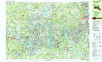
1987 Map of Framingham
USGS Topo · Published 1987About this map
The Massachusetts Turnpike serves as a modern spine across this late-1980s landscape, connecting the densely settled hubs of Framingham and Natick. This era shows a transition from historical village centers like Saxonville and Framingham Center to a suburban and institutional corridor defined by major academic and medical facilities. Prominent campus footprints include Wellesley College near Lake Waban, Regis College in Weston, and the State Hospital complex.
Find a feature on this map
111 named features on this map. Tap any name to fly to it.
Don’t see what you’re looking for? This feature index may not catch every label — zoom into the map to look around manually.
Map Details
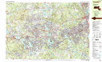
Editions of this 1987 Framingham Map
2 editions found
Other maps of this area

1886 · Blackstone
USGS Topo · 1:62,500

1886 · Dedham
USGS Topo · 1:62,500

1886 · Framingham
USGS Topo · 1:62,500

1887 · Franklin
USGS Topo · 1:62,500

1887 · Marlboro
USGS Topo · 1:62,500

1889 · Marlboro
USGS Topo · 1:62,500

1889 · Blackstone
USGS Topo · 1:62,500

1889 · Franklin
USGS Topo · 1:62,500

1889 · Framingham
USGS Topo · 1:62,500

1893 · Franklin
USGS Topo · 1:62,500