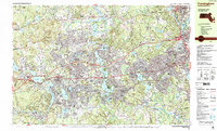
1987 Map of Framingham
USGS Topo · Published 1987About this map
Framingham and Natick are centers of dense suburban activity in the late 1980s, where older town centers meet significant postwar development. The landscape is defined by its massive water systems, from the expansive Lake Cochituate and Foss Reservoir (No 3) to the winding Sudbury River. This era shows the established footprint of academic institutions like Wellesley College, Babson College, and Regis College, which occupy large tracts of the eastern landscape. Transport networks are dominant, with the Massachusetts Turnpike cutting through the center and the Conrail MBTA lines linking these communities to the larger Boston metropolitan area. Notable landmarks such as the State Hospital and several Radio Towers indicate the regional infrastructure of the time, while Sudbury State Forest and Richard Callahan State Park provide significant preserved open space amidst the residential growth.
Find a feature on this map
109 named features on this map. Tap any name to fly to it.
Don’t see what you’re looking for? This feature index may not catch every label — zoom into the map to look around manually.
Map Details
Editions of this 1987 Framingham Map
2 editions found
Other maps of this area

1886 · Blackstone
USGS Topo · 1:62,500

1886 · Dedham
USGS Topo · 1:62,500

1886 · Framingham
USGS Topo · 1:62,500

1887 · Franklin
USGS Topo · 1:62,500

1887 · Marlboro
USGS Topo · 1:62,500

1889 · Marlboro
USGS Topo · 1:62,500

1889 · Blackstone
USGS Topo · 1:62,500

1889 · Franklin
USGS Topo · 1:62,500

1889 · Framingham
USGS Topo · 1:62,500

1893 · Franklin
USGS Topo · 1:62,500