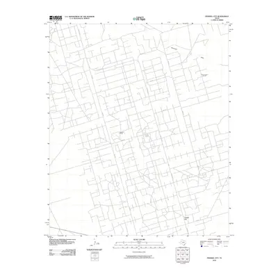
2010 Map of Frankel City
USGS Topo · Published 2010About this map
Frankel City sits at the southern edge of this West Texas landscape, defined by an intricate network of industrial access roads and energy production sites. The terrain is dominated by the sprawling infrastructure of the Fullerton Oil Field and the Fullerton East Oil Field, where a dense grid of local roads like NW 8000 and NW 7001 provide access to the Permian Basin's mineral wealth. The only major natural drainage through this engineered environment is Monument Draw, which cuts across the northeast corner of the quadrangle. Transportation is anchored by Ranch Rd 181, which serves as the primary north-south artery connecting these industrial zones to the small settlement at Frankel City and intersecting with FM 1967 to the east.
Find a feature on this map
14 named features on this map. Tap any name to fly to it.
Don’t see what you’re looking for? This feature index may not catch every label — zoom into the map to look around manually.
Map Details
Editions of this 2010 Frankel City Map
This is the sole edition of this map. No revisions or reprints were ever made.
Other maps of this area

1954 · Hobbs
USGS Topo · 1:250,000

1958 · Hobbs
USGS Topo · 1:250,000

1969 · Seminole SW
USGS Topo · 1:24,000

1971 · Brinson Ranch
USGS Topo · 1:24,000

1971 · Paynes Corner SE
USGS Topo · 1:24,000

1971 · Frankel City
USGS Topo · 1:24,000

1971 · Jumbo Hill
USGS Topo · 1:24,000

1971 · Whalen Lake
USGS Topo · 1:24,000

1971 · Frankel City SW
USGS Topo · 1:24,000

1971 · Shafter Lake
USGS Topo · 1:24,000