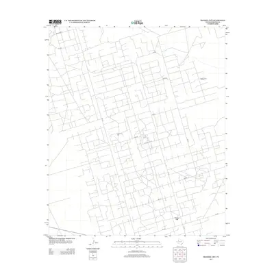
2012 Map of Frankel City
USGS Topo · Published 2012About this map
Frankel City sits at the heart of this Andrews County landscape, defined by a dense geometric web of service roads and industrial infrastructure. The region's economy is visibly tied to the petroleum industry, dominated by the expansive Fullerton Oil Field and the adjacent Fullerton East Oil Field. A sprawling network of corridors, including Exxon Rd and Phillips Plant Rd, crisscrosses the terrain to support energy extraction. This survey documents the intensive land use in West Texas during the early 21st century, where the grid-like road system connects various production sites to major thoroughfares like FM 181. The map reveals how the extraction of natural resources has reshaped the natural environment into a highly organized industrial workspace.
Find a feature on this map
16 named features on this map. Tap any name to fly to it.
Don’t see what you’re looking for? This feature index may not catch every label — zoom into the map to look around manually.
Map Details
Editions of this 2012 Frankel City Map
This is the sole edition of this map. No revisions or reprints were ever made.
Other maps of this area

1954 · Hobbs
USGS Topo · 1:250,000

1958 · Hobbs
USGS Topo · 1:250,000

1969 · Seminole SW
USGS Topo · 1:24,000

1971 · Brinson Ranch
USGS Topo · 1:24,000

1971 · Paynes Corner SE
USGS Topo · 1:24,000

1971 · Frankel City
USGS Topo · 1:24,000

1971 · Jumbo Hill
USGS Topo · 1:24,000

1971 · Whalen Lake
USGS Topo · 1:24,000

1971 · Frankel City SW
USGS Topo · 1:24,000

1971 · Shafter Lake
USGS Topo · 1:24,000