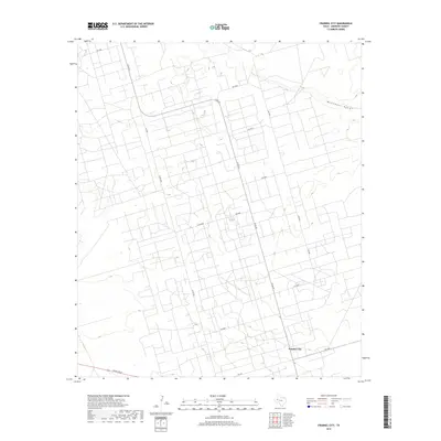
2019 Map of Frankel City
USGS Topo · Published 2019About this map
Frankel City sits at the heart of this Permian Basin landscape, characterized by a dense, systematic grid of service roads and industrial infrastructure. The settlement is positioned near the junction of N Fm 181 and Fm 1967, serving as a focal point for the surrounding region. The terrain is marked by the subtle depression of Monument Draw, which meanders across the northeast corner of the sheet, providing a natural contrast to the rigid geometry of the local road network. This network, including routes like Co Rd 8000 and Co Rd 7001, reveals a landscape heavily modified for resource extraction and transport. To the southwest, Ranch Rd 87 cuts through the territory, highlighting the importance of connectivity between isolated hubs in Andrews County during this recent era of energy production.
Find a feature on this map
17 named features on this map. Tap any name to fly to it.
Don’t see what you’re looking for? This feature index may not catch every label — zoom into the map to look around manually.
Map Details
Editions of this 2019 Frankel City Map
This is the sole edition of this map. No revisions or reprints were ever made.
Other maps of this area

1954 · Hobbs
USGS Topo · 1:250,000

1958 · Hobbs
USGS Topo · 1:250,000

1969 · Seminole SW
USGS Topo · 1:24,000

1971 · Brinson Ranch
USGS Topo · 1:24,000

1971 · Paynes Corner SE
USGS Topo · 1:24,000

1971 · Frankel City
USGS Topo · 1:24,000

1971 · Jumbo Hill
USGS Topo · 1:24,000

1971 · Whalen Lake
USGS Topo · 1:24,000

1971 · Frankel City SW
USGS Topo · 1:24,000

1971 · Shafter Lake
USGS Topo · 1:24,000