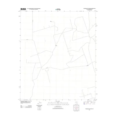
2012 Map of Frankel City SW
USGS Topo · Published 2012About this map
Windmills and ranch roads define this semi-arid landscape in Andrews County, where water management is central to the local economy and survival. Remote markers such as West Windmill, Double Windmill, and South Windmill serve as critical landmarks in an area otherwise characterized by vast stretches of open terrain. The transportation network is built upon long, straight paths including Nelson Rd, Co Rd 200, and Sw 9001, which facilitate movement between these isolated watering points and larger regional centers. This 2012 survey illustrates the enduring patterns of West Texas land use, where infrastructure is sparsely distributed and often centered around cattle ranching or industrial utility.
Find a feature on this map
6 named features on this map. Tap any name to fly to it.
Don’t see what you’re looking for? This feature index may not catch every label — zoom into the map to look around manually.
Map Details
Editions of this 2012 Frankel City SW Map
This is the sole edition of this map. No revisions or reprints were ever made.
Other maps of this area

1954 · Hobbs
USGS Topo · 1:250,000

1958 · Hobbs
USGS Topo · 1:250,000

1969 · Jal NE
USGS Topo · 1:24,000

1969 · Eunice NE
USGS Topo · 1:24,000

1969 · Eunice SE
USGS Topo · 1:24,000

1971 · Frankel City
USGS Topo · 1:24,000

1971 · Jumbo Hill
USGS Topo · 1:24,000

1971 · Figure Seven Ranch
USGS Topo · 1:24,000

1971 · Whalen Lake
USGS Topo · 1:24,000

1971 · Frankel City SW
USGS Topo · 1:24,000