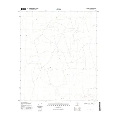
2016 Map of Frankel City SW
USGS Topo · Published 2016About this map
Andrews County's high plains terrain in the Permian Basin reveals a landscape defined by industrial and agricultural transport routes. This 2016 survey focuses on a sparsely populated region where a network of section lines and access roads, including Nelson Rd, support the area's local activity. The topographic layout is characterized by subtle elevation changes and numerous depressions, many of which are identified as wetlands by the National Wetlands Inventory. Infrastructure like Sw 200 and Sw 9001 serves as the primary navigation framework across this West Texas landscape, showing the distribution of modern rural development and land use patterns just south of the local oil fields.
Find a feature on this map
3 named features on this map. Tap any name to fly to it.
Don’t see what you’re looking for? This feature index may not catch every label — zoom into the map to look around manually.
Map Details
Editions of this 2016 Frankel City SW Map
This is the sole edition of this map. No revisions or reprints were ever made.
Other maps of this area

1954 · Hobbs
USGS Topo · 1:250,000

1958 · Hobbs
USGS Topo · 1:250,000

1969 · Jal NE
USGS Topo · 1:24,000

1969 · Eunice NE
USGS Topo · 1:24,000

1969 · Eunice SE
USGS Topo · 1:24,000

1971 · Frankel City
USGS Topo · 1:24,000

1971 · Jumbo Hill
USGS Topo · 1:24,000

1971 · Figure Seven Ranch
USGS Topo · 1:24,000

1971 · Whalen Lake
USGS Topo · 1:24,000

1971 · Frankel City SW
USGS Topo · 1:24,000