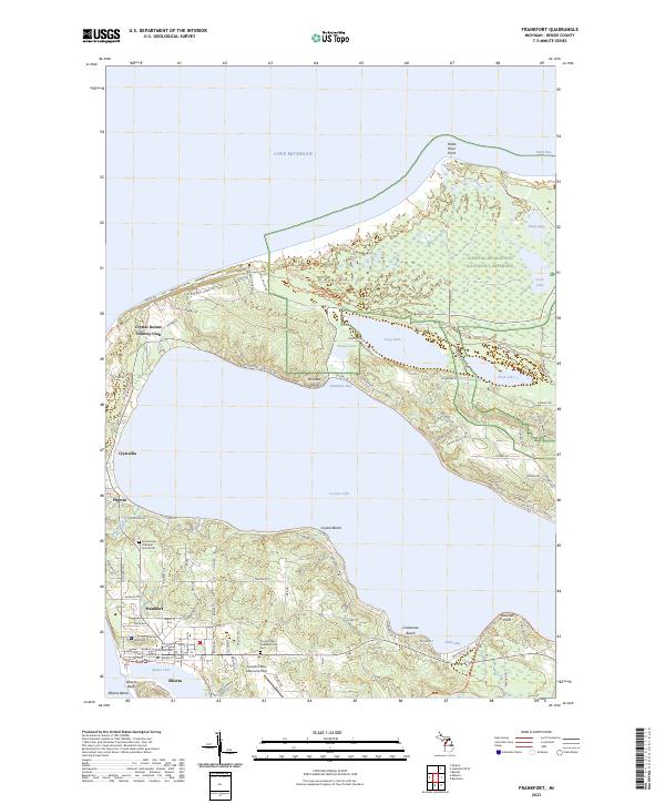
2023 Map of Frankfort
USGS Topo · Published 2023About this map
Frankfort and Elberta serve as the primary hubs on this coastal sheet, situated where Betsie Lake meets the expansive Lake Michigan shoreline. The landscape is defined by its deep relationship with water, anchored by the massive interior basin of Crystal Lake, which is ringed by smaller settlements like Crystallia, Pilgrim, and Crystal Beach. To the north, the protected wilderness of Sleeping Bear Dunes National Lakeshore encompasses a complex of smaller bodies including Long Lake, Round Lake, and Rush Lake. Genealogists and local historians can locate civic landmarks such as the Crystal Lake Township Cem North and Crystal Lake Township Cem East, while the northern hills are home to the Crystal Downs Country Club. The geography illustrates a specialized maritime and resort economy, from the docks of Frankfort to the sandy reaches of Platte River Point.
Find a feature on this map
111 named features on this map. Tap any name to fly to it.
Don’t see what you’re looking for? This feature index may not catch every label — zoom into the map to look around manually.
Map Details
Editions of this 2023 Frankfort Map
This is the sole edition of this map. No revisions or reprints were ever made.
Other maps of this area

1954 · Manitowoc
USGS Topo · 1:250,000

1956 · Frankfort
USGS Topo · 1:62,500

1957 · Empire
USGS Topo · 1:62,500

1958 · Manitowoc
USGS Topo · 1:250,000

1976 · Frankfort SE
USGS Topo · 1:24,000

1976 · Frankfort NW
USGS Topo · 1:24,000

1976 · Frankfort SW
USGS Topo · 1:24,000
1976 · Frankfort NE
USGS Topo · 1:24,000
1983 · Beulah
USGS Topo · 1:25,000
1983 · Empire
USGS Topo · 1:25,000