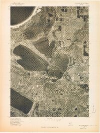
1976 Map of Frankfort NE
USGS Topo · Published 1976About this map
Platte Lake dominates the central landscape of this 1976 orthophotoquad, situated between the expansive waters of Lake Michigan to the northwest and Crystal Lake to the southwest. This aerial-based perspective captures the mid-seventies distribution of timberland and clearings around the village of Honor and the community of Beulah. The map provides an overhead view of the coastal environment during a period of established residential patterns along the various shorelines. Because this is an orthophoto-style record, it reveals the fine-grained texture of the Benzie County woods and fields as they appeared when the photography was taken in May of 1976, offering a visual benchmark for researchers studying the development of this northern Michigan waterfront region.
Find a feature on this map
5 named features on this map. Tap any name to fly to it.
Don’t see what you’re looking for? This feature index may not catch every label — zoom into the map to look around manually.
Map Details
Editions of this 1976 Frankfort NE Map
This is the sole edition of this map. No revisions or reprints were ever made.
Other maps of this area

1954 · Traverse City
USGS Topo · 1:250,000

1954 · Manitowoc
USGS Topo · 1:250,000

1956 · Thompsonville
USGS Topo · 1:62,500

1956 · Frankfort
USGS Topo · 1:62,500

1957 · Empire
USGS Topo · 1:62,500

1957 · Maple City
USGS Topo · 1:62,500

1958 · Traverse City
USGS Topo · 1:250,000

1958 · Manitowoc
USGS Topo · 1:250,000

1976 · Frankfort SE
USGS Topo · 1:24,000

1976 · Frankfort NW
USGS Topo · 1:24,000