
1976 Map of Frankfort NW
USGS Topo · Published 1976About this map
Crystal Lake dominates the central landscape of this 1976 orthophotoquad, showcasing the distinct geography of Benzie County along the shore of Lake Michigan. The imagery captures the narrow strip of land separating the inland waters from the Great Lake, where the settlement of Frankfort is positioned at the southern harbor entrance. Further north along the western shoreline lies Pilgrim, providing a clear view of mid-1970s residential and coastal development. This specific advance print utilizes aerial photography from May 1976 to document the vegetation patterns and shoreline structures before the summer season. The contrast between the deep waters of the lake and the surrounding forested dunes offers researchers a precise look at the land use and natural boundaries of this coastal region during the mid-seventies.
Find a feature on this map
4 named features on this map. Tap any name to fly to it.
Don’t see what you’re looking for? This feature index may not catch every label — zoom into the map to look around manually.
Map Details
Editions of this 1976 Frankfort NW Map
This is the sole edition of this map. No revisions or reprints were ever made.
Other maps of this area

1954 · Manitowoc
USGS Topo · 1:250,000

1956 · Frankfort
USGS Topo · 1:62,500

1957 · Empire
USGS Topo · 1:62,500

1958 · Manitowoc
USGS Topo · 1:250,000

1976 · Frankfort SE
USGS Topo · 1:24,000

1976 · Frankfort SW
USGS Topo · 1:24,000
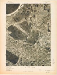
1976 · Frankfort NE
USGS Topo · 1:24,000
1983 · Beulah
USGS Topo · 1:25,000
1983 · Empire
USGS Topo · 1:25,000
1983 · Benzonia
USGS Topo · 1:25,000
Featured Places
- Frankfort, MI
- Elberta, Gilmore Township
- Pilgrim, Crystal Lake Township
- Crystal Lake Township, MI
- Gilmore Township, MI