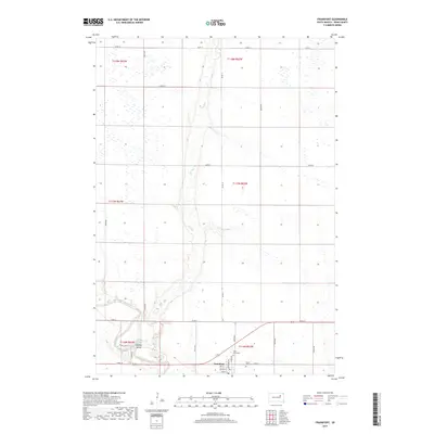
2017 Map of Frankfort
USGS Topo · Published 2017About this map
Frankfort anchors the southeastern corner of this Spink County landscape, where the local street grid including Pine St and Maple St meets the open agricultural plains. The town is flanked by historic burial sites, with Mount Hope Cem to the east and Saint Anne Cem to the north, providing valuable points of reference for genealogists tracing early families. The surrounding terrain is defined by the winding course of the James River, which cuts through the southwest near Fisher Grove A.
Find a feature on this map
23 named features on this map. Tap any name to fly to it.
Don’t see what you’re looking for? This feature index may not catch every label — zoom into the map to look around manually.
Map Details
Editions of this 2017 Frankfort Map
This is the sole edition of this map. No revisions or reprints were ever made.
Other maps of this area

1894 · Conde
USGS Topo · 1:62,500

1895 · Byron
USGS Topo · 1:125,000

1895 · Aberdeen
USGS Topo · 1:125,000

1953 · Frankfort
USGS Topo · 1:24,000

1953 · Gallup
USGS Topo · 1:24,000

1953 · Ashton
USGS Topo · 1:24,000

1953 · Huron
USGS Topo · 1:250,000

1954 · Aberdeen
USGS Topo · 1:250,000

1954 · Huron
USGS Topo · 1:250,000

1956 · Aberdeen
USGS Topo · 1:250,000