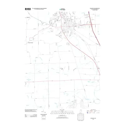
2013 Map of Franklin
USGS Topo · Published 2013About this map
Youngs Cr and its various tributaries, including Hurricane Cr and the extensive Canary Ditch system, define the drainage of this Johnson County landscape. The area shows a transition from the established settlement at Hopewell in the northwest to the agricultural lands surrounding Amity in the southeast. Regional aviation is represented by the Franklin Flying Field Airport, situated centrally among the grid of county roads. The map captures a sophisticated network of water management features like Hazelett Ditch and Vandivier Ditch, which support the surrounding farms. Local recreation and geography are further detailed through numerous private and named bodies of water, such as Ray Willoughby Lake, Pisgah Lake, and Stone Arch Lake, reflecting the land use patterns of the early 21st century.
Find a feature on this map
93 named features on this map. Tap any name to fly to it.
Don’t see what you’re looking for? This feature index may not catch every label — zoom into the map to look around manually.
Map Details
Editions of this 2013 Franklin Map
This is the sole edition of this map. No revisions or reprints were ever made.
Other maps of this area

1942 · Franklin
USGS Topo · 1:125,000

1942 · Columbus
USGS Topo · 1:125,000

1947 · Franklin
USGS Topo · 1:62,500

1948 · Franklin
USGS Topo · 1:24,000

1948 · Edinburg
USGS Topo · 1:24,000

1948 · Trafalgar
USGS Topo · 1:24,000

1948 · Nineveh
USGS Topo · 1:24,000

1948 · Marietta
USGS Topo · 1:24,000

1948 · Fruitdale
USGS Topo · 1:24,000

1950 · Franklin
USGS Topo · 1:62,500