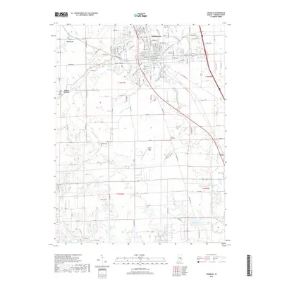
2019 Map of Franklin
USGS Topo · Published 2019About this map
Franklin serves as the central hub of this Johnson County landscape, where the urban grid meets a complex network of agricultural drainage and natural waterways. The city is bordered by significant local landmarks including Greenlawn Cem and the Franklin Flying Field, reflecting the town's expansion and infrastructure. Water management is a defining characteristic of the surrounding countryside, seen in the convergence of Youngs Creek, Hurricane Cr, and engineered channels like Canary Ditch and Hazelett Ditch. These waterways historically dictated the placement of early settlements and family homesteads.
Find a feature on this map
83 named features on this map. Tap any name to fly to it.
Don’t see what you’re looking for? This feature index may not catch every label — zoom into the map to look around manually.
Map Details
Editions of this 2019 Franklin Map
This is the sole edition of this map. No revisions or reprints were ever made.
Other maps of this area

1942 · Franklin
USGS Topo · 1:125,000

1942 · Columbus
USGS Topo · 1:125,000

1947 · Franklin
USGS Topo · 1:62,500

1948 · Franklin
USGS Topo · 1:24,000

1948 · Edinburg
USGS Topo · 1:24,000

1948 · Trafalgar
USGS Topo · 1:24,000

1948 · Nineveh
USGS Topo · 1:24,000

1948 · Marietta
USGS Topo · 1:24,000

1948 · Fruitdale
USGS Topo · 1:24,000

1950 · Franklin
USGS Topo · 1:62,500