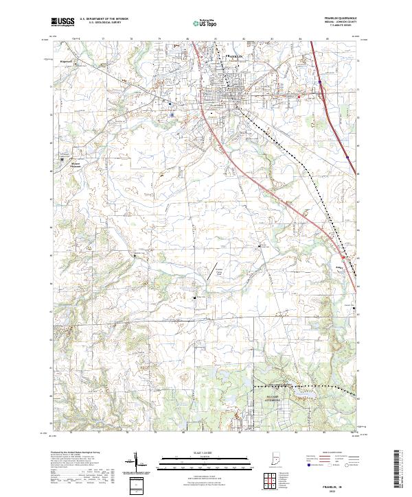
2022 Map of Franklin
USGS Topo · Published 2022About this map
Franklin serves as the central hub for Johnson County, anchored by the Johnson County Courthouse and the sprawling campus of Franklin College. The landscape is defined by the branching waters of Youngs Creek and its many tributaries, including Hurricane Cr and Buckhart Cr, which snake through the fertile plains. Beyond the city center, the terrain is dotted with small outlying communities like Hopewell and Amity, alongside specialized sites such as the Franklin Flying Field. This map reveal a deeply rooted agricultural and institutional heritage, evidenced by numerous family and community burial grounds including Mullikin Cem and Hamner Cem. The intricate network of drainage ditches, such as Vandivier Ditch and Amity Ditch, illustrates a long history of water management to support the region's productive farmland.
Find a feature on this map
93 named features on this map. Tap any name to fly to it.
Don’t see what you’re looking for? This feature index may not catch every label — zoom into the map to look around manually.
Map Details
Editions of this 2022 Franklin Map
This is the sole edition of this map. No revisions or reprints were ever made.
Other maps of this area

1942 · Franklin
USGS Topo · 1:125,000

1942 · Columbus
USGS Topo · 1:125,000

1947 · Franklin
USGS Topo · 1:62,500

1948 · Franklin
USGS Topo · 1:24,000

1948 · Edinburg
USGS Topo · 1:24,000

1948 · Trafalgar
USGS Topo · 1:24,000

1948 · Nineveh
USGS Topo · 1:24,000

1948 · Marietta
USGS Topo · 1:24,000

1948 · Fruitdale
USGS Topo · 1:24,000

1950 · Franklin
USGS Topo · 1:62,500