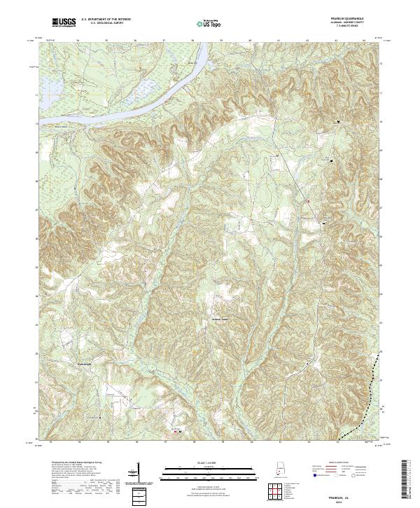
2024 Map of Franklin
USGS Topo · Published 2024About this map
The Alabama River winds through the northwestern corner of this territory, carving out features like Haines Island and Bates Bar. The interior is defined by a series of small, dispersed settlements including Morrissette, Wainwright, and the uniquely named Scratch Ankle. These communities are connected by a network of rural roads such as Co Rd 17 and Old Scotland Rd, which trace the high ridges between numerous creek drainages.
Find a feature on this map
59 named features on this map. Tap any name to fly to it.
Don’t see what you’re looking for? This feature index may not catch every label — zoom into the map to look around manually.
Map Details
Editions of this 2024 Franklin Map
This is the sole edition of this map. No revisions or reprints were ever made.
Other maps of this area

1953 · Andalusia
USGS Topo · 1:250,000

1957 · Andalusia
USGS Topo · 1:250,000

1972 · Monroeville
USGS Topo · 1:24,000

1972 · Natchez
USGS Topo · 1:24,000

1972 · Franklin
USGS Topo · 1:24,000

1972 · Mexia
USGS Topo · 1:24,000

1972 · Claiborne
USGS Topo · 1:24,000

1972 · Chance
USGS Topo · 1:24,000

1973 · Hybart
USGS Topo · 1:24,000

1973 · Lower Peach Tree
USGS Topo · 1:24,000