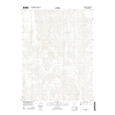
2014 Map of Franklin NE
USGS Topo · Published 2014About this map
Thompson Creek and its many tributaries carve through the rural landscape of Franklin County in this 2014 survey. The drainage network is particularly complex here, with the Middle Br Thompson Cr, E Br Thompson Cr, and W Br Thompson Cr converging to define the local topography. In the northwest, Bartels Reservoir provides a localized water catchment amidst a strictly organized grid of rural roads, including R Rd and 37 Rd. The map illustrates a section of the Great Plains where the transition from flat upland plateaus to dissected stream valleys like those of Sassacus Cr is sharp and rhythmic. This modern topographic study is an essential resource for understanding contemporary land use and watershed patterns in south-central Nebraska.
Find a feature on this map
22 named features on this map. Tap any name to fly to it.
Don’t see what you’re looking for? This feature index may not catch every label — zoom into the map to look around manually.
Map Details
Editions of this 2014 Franklin NE Map
This is the sole edition of this map. No revisions or reprints were ever made.
Other maps of this area

1897 · Red Cloud
USGS Topo · 1:125,000

1940 · Red Cloud
USGS Topo · 1:62,500

1942 · Red Cloud
USGS Topo · 1:62,500

1955 · Grand Island
USGS Topo · 1:250,000

1957 · Grand Island
USGS Topo · 1:250,000

1958 · Grand Island
USGS Topo · 1:250,000

1969 · Upland
USGS Topo · 1:24,000

1969 · Upland SE
USGS Topo · 1:24,000
1969 · Campbell
USGS Topo · 1:24,000
1973 · Macon
USGS Topo · 1:24,000