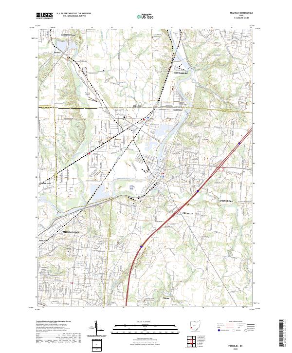
2023 Map of Franklin
USGS Topo · Published 2023About this map
The Great Miami River corridor serves as the primary axis for this region of southwestern Ohio, where dense residential development meets the industrial and educational hubs of Franklin, Middletown, and Miamisburg. The landscape is shaped by the convergence of significant waterways, including Twin Creek and Clear Creek, and is bisected by the Norfolk Southern rail line. This modern survey illustrates the suburban expansion of communities like Springboro and Carlisle, while preserving the locations of earlier landmarks such as the Tapscott Cem and Swartzel Cem. The presence of institutions like Miami University Middletown and the Greentree Health Science Academy reflects the contemporary character of the area, even as family-named roads and rural settlements like Germantown and Hunter anchor the map's historical geography.
Find a feature on this map
268 named features on this map. Tap any name to fly to it.
Don’t see what you’re looking for? This feature index may not catch every label — zoom into the map to look around manually.
Map Details
Editions of this 2023 Franklin Map
This is the sole edition of this map. No revisions or reprints were ever made.
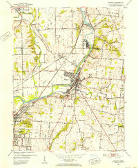
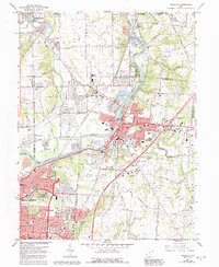
Historical Maps of Eldorado Through Time
3 maps found