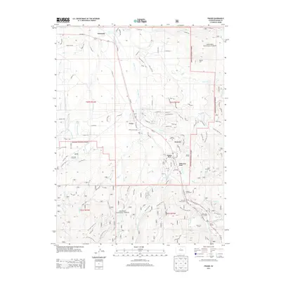
2013 Map of Fraser
USGS Topo · Published 2013About this map
The Fraser River corridor serves as the central artery for this high-altitude region, where the town of Fraser and the resort community of Winter Park are established. This 2013 survey shows a landscape heavily influenced by both recreation and critical infrastructure, most notably the eastern end of the Moffat railroad line. The presence of the Moffat Tunnel and its West Portal underscore the area's importance to transcontinental transit, while the Idlewild Ski Area and Winter Park Ski Area reflect its modern character as a recreational hub.
Find a feature on this map
133 named features on this map. Tap any name to fly to it.
Don’t see what you’re looking for? This feature index may not catch every label — zoom into the map to look around manually.
Map Details
Editions of this 2013 Fraser Map
This is the sole edition of this map. No revisions or reprints were ever made.
Other maps of this area

1905 · Central City
USGS Topo · 1:62,500

1910 · Central City
USGS Topo · 1:62,500

1912 · Central City
USGS Topo · 1:62,500

1915 · Longs Peak
USGS Topo · 1:125,000

1919 · Rocky Mountain National Park
USGS Topo · 1:125,000

1924 · Fraser
USGS Topo · 1:62,500

1926 · Fraser
USGS Topo · 1:62,500

1953 · Denver
USGS Topo · 1:250,000

1954 · Greeley
USGS Topo · 1:250,000

1957 · Denver
USGS Topo · 1:250,000