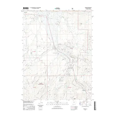
2016 Map of Fraser
USGS Topo · Published 2016About this map
The Fraser River valley serves as a primary corridor for transportation and settlement in this portion of the Rockies, anchoring towns like Fraser and Tabernash. The landscape is defined by the transition from the valley floor to the high elevations of the Arapahoe National Forest, where the Moffat Tunnel and Arrow Tunnel underscore the engineering required to breach the Continental Divide. Local history is preserved at the Fraser Cem and Arrow Spring Cem, while the complex water management of the region is evident in the network of irrigation features such as the Crooked Cr Supply Ditch and Saint Louis Ditch. In the south, the development of Winter Park and Hideaway Park reflects the area's growth as a hub for outdoor recreation, situated among peaks like Marker Hill and drained by numerous tributaries including Vasquez Cr and Leland Creek.
Find a feature on this map
205 named features on this map. Tap any name to fly to it.
Don’t see what you’re looking for? This feature index may not catch every label — zoom into the map to look around manually.
Map Details
Editions of this 2016 Fraser Map
This is the sole edition of this map. No revisions or reprints were ever made.
Other maps of this area

1905 · Central City
USGS Topo · 1:62,500

1910 · Central City
USGS Topo · 1:62,500

1912 · Central City
USGS Topo · 1:62,500

1915 · Longs Peak
USGS Topo · 1:125,000

1919 · Rocky Mountain National Park
USGS Topo · 1:125,000

1924 · Fraser
USGS Topo · 1:62,500

1926 · Fraser
USGS Topo · 1:62,500

1953 · Denver
USGS Topo · 1:250,000

1954 · Greeley
USGS Topo · 1:250,000

1957 · Denver
USGS Topo · 1:250,000