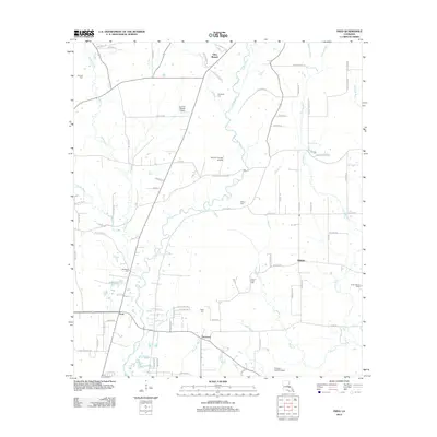
2012 Map of Fred
USGS Topo · Published 2012About this map
The Comite River meanders through this landscape north of Baton Rouge, shaping the settlement patterns of small communities like Fred and Deerford. The area is characterized by a dense network of watercourses, including Beaver Cr and Redwood Cr, which historically dictated the placement of homesteads and local roads. Genealogists will find a high density of family and community burial grounds across the territory, such as Mount Holly Cem, Redwood Cem, and Douglass Cem, offering clues to the early residents of this Louisiana parish. Aviation activity is evident through private facilities like Country Breeze Airport and the Annison Private Airport, while recreational or social service sites like the Junior Deputy Camp reflect the mid-to-late 20th-century development of the region beyond simple agriculture.
Find a feature on this map
78 named features on this map. Tap any name to fly to it.
Don’t see what you’re looking for? This feature index may not catch every label — zoom into the map to look around manually.
Map Details
Editions of this 2012 Fred Map
This is the sole edition of this map. No revisions or reprints were ever made.
Other maps of this area

1906 · Bayou Sara
USGS Topo · 1:125,000

1939 · Zachary
USGS Topo · 1:62,500

1942 · Pride
USGS Topo · 1:31,680

1942 · Watson
USGS Topo · 1:31,680

1945 · Jackson
USGS Topo · 1:31,680

1946 · Clinton
USGS Topo · 1:31,680

1949 · Bluff Creek
USGS Topo · 1:31,680

1953 · Comite
USGS Topo · 1:24,000
1954 · Watson
USGS Topo · 1:24,000
1954 · Pride
USGS Topo · 1:24,000