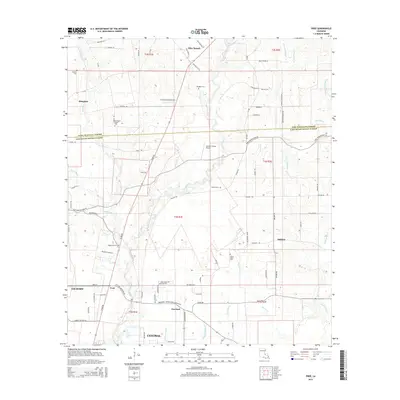
2015 Map of Fred
USGS Topo · Published 2015About this map
Central and Zachary anchor this 2015 survey of the transition between the rolling hills of Olive Branch and the suburban reaches north of the Louisiana state capital. The landscape is defined by the winding course of the Comite River, which bisects the area amidst a network of bayous and creeks including Doyle Bayou and Blackwater Bayou. Historically significant family and community markers are numerous throughout the rural landscape, from Douglass Cem near Olive Branch to the Black Cem and Ballard Cem further south. The map documents a blend of established settlements like Slaughter and Deerford alongside modern infrastructure, including the Annison Private Airport and Country Breeze Airport. This record of East Baton Rouge Parish and East Feliciana Parish shows the persistent rural character of these crossroads communities even as residential roads like Arleen Ave and Watson Dr expand.
Find a feature on this map
85 named features on this map. Tap any name to fly to it.
Don’t see what you’re looking for? This feature index may not catch every label — zoom into the map to look around manually.
Map Details
Editions of this 2015 Fred Map
This is the sole edition of this map. No revisions or reprints were ever made.
Other maps of this area

1906 · Bayou Sara
USGS Topo · 1:125,000

1939 · Zachary
USGS Topo · 1:62,500

1942 · Pride
USGS Topo · 1:31,680

1942 · Watson
USGS Topo · 1:31,680

1945 · Jackson
USGS Topo · 1:31,680

1946 · Clinton
USGS Topo · 1:31,680

1949 · Bluff Creek
USGS Topo · 1:31,680

1953 · Comite
USGS Topo · 1:24,000
1954 · Watson
USGS Topo · 1:24,000
1954 · Pride
USGS Topo · 1:24,000