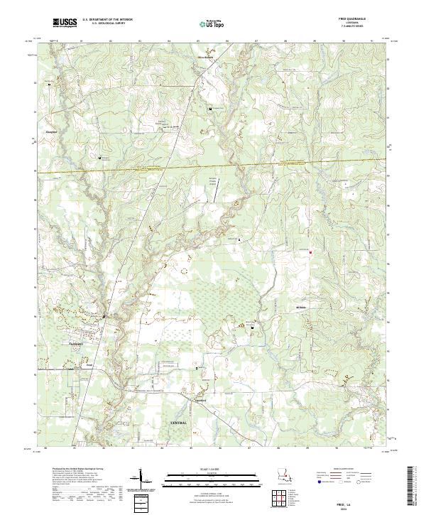
2024 Map of Fred
USGS Topo · Published 2024About this map
The northern reaches of the Zachary area and the outskirts of Central define this modern landscape where the Comite River and Beaver Creek wind through the borderlands of East Feliciana and East Baton Rouge parishes. This survey captures a rural-suburban interface characterized by family landmarks and small communities like Milldale, Deerford, and Slaughter. Local heritage is preserved in numerous scattered burial grounds, including the Overton Cem and Strangers Home Cem to the northwest, as well as the Mount Holly Grove Cem near the river banks. The area's transit and infrastructure are anchored by the north-south artery of Plank Rd and small aviation facilities such as the Annison Private Airport, reflecting the continued importance of these historical corridors for regional movement.
Find a feature on this map
92 named features on this map. Tap any name to fly to it.
Don’t see what you’re looking for? This feature index may not catch every label — zoom into the map to look around manually.
Map Details
Editions of this 2024 Fred Map
This is the sole edition of this map. No revisions or reprints were ever made.
Other maps of this area

1906 · Bayou Sara
USGS Topo · 1:125,000

1939 · Zachary
USGS Topo · 1:62,500

1942 · Pride
USGS Topo · 1:31,680

1942 · Watson
USGS Topo · 1:31,680

1945 · Jackson
USGS Topo · 1:31,680

1946 · Clinton
USGS Topo · 1:31,680

1949 · Bluff Creek
USGS Topo · 1:31,680

1953 · Comite
USGS Topo · 1:24,000
1954 · Watson
USGS Topo · 1:24,000
1954 · Pride
USGS Topo · 1:24,000