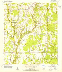
1954 Map of Fred
USGS Topo · Published 1955About this map
The Comite River meanders south through this mid-century landscape, marking a rural territory where the borders of East Feliciana Parish and East Baton Rouge Parish meet. This survey reveals a community deeply rooted in its local institutions, evidenced by the numerous country churches and schools that serve the area. The small settlements of Fred and Deerford sit alongside agricultural land and timber tracts, connected by a network of secondary roads and a prominent pipe line that traverses the terrain.
Find a feature on this map
39 named features on this map. Tap any name to fly to it.
Don’t see what you’re looking for? This feature index may not catch every label — zoom into the map to look around manually.
Map Details
Editions of this 1954 Fred Map
This is the sole edition of this map. No revisions or reprints were ever made.
Other maps of this area

1906 · Bayou Sara
USGS Topo · 1:125,000

1939 · Zachary
USGS Topo · 1:62,500

1942 · Pride
USGS Topo · 1:31,680

1942 · Watson
USGS Topo · 1:31,680

1945 · Jackson
USGS Topo · 1:31,680

1946 · Clinton
USGS Topo · 1:31,680

1949 · Bluff Creek
USGS Topo · 1:31,680

1953 · Comite
USGS Topo · 1:24,000
1954 · Watson
USGS Topo · 1:24,000
1954 · Pride
USGS Topo · 1:24,000