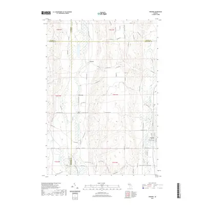
2019 Map of Frederic
USGS Topo · Published 2019About this map
The Manistee River and Au Sable River converge conceptually in this northern Michigan landscape, where the headwaters of these major systems drain a territory defined by glacial terrain and historical timber activity. The settlement of Frederic serves as a primary anchor in the southeast, situated near May Lake and Camel Lake. Further north, the locations of Deward and Ishaward signify the area's development along the upper reaches of the Manistee. Local history is preserved at Oakwood Cem and Shrine Cem, while the rugged relief is punctuated by Toll Hill. An extensive network of logging roads and modern trails like N Blue Bear Trl and Deward Trl crisscross the terrain, reflecting the long-standing use of these forests for both industry and recreation.
Find a feature on this map
82 named features on this map. Tap any name to fly to it.
Don’t see what you’re looking for? This feature index may not catch every label — zoom into the map to look around manually.
Map Details
Editions of this 2019 Frederic Map
This is the sole edition of this map. No revisions or reprints were ever made.
Other maps of this area

1949 · Black Creek
USGS Topo · 1:24,000

1949 · Otsego Lake
USGS Topo · 1:62,500

1949 · Fletcher
USGS Topo · 1:62,500

1949 · Grayling
USGS Topo · 1:62,500

1950 · Lake Margrethe
USGS Topo · 1:24,000

1950 · Grayling
USGS Topo · 1:24,000

1951 · Big Bradford Lake
USGS Topo · 1:24,000

1951 · Grayling
USGS Topo · 1:24,000

1951 · Otsego Lake
USGS Topo · 1:24,000

1954 · Traverse City
USGS Topo · 1:250,000