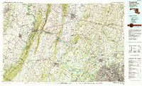
1984 Map of Frederick
USGS Topo · Published 1985About this map
The Potomac River carves a winding path through the heart of this mid-1980s landscape, serving as the jurisdictional boundary for Maryland, Virginia, and West Virginia. This region is defined by its significant historical preserves, including Antietam National Battlefield and Harpers Ferry National Historical Park, where the Shenandoah River meets the Potomac. The map illustrates a period of significant suburban expansion along the Interstate 270 corridor, connecting Gaithersburg and Rockville to the rural north.
Find a feature on this map
258 named features on this map. Tap any name to fly to it.
Don’t see what you’re looking for? This feature index may not catch every label — zoom into the map to look around manually.
Map Details
Editions of this 1984 Frederick Map
This is the sole edition of this map. No revisions or reprints were ever made.
Other maps of this area

1884 · Harpers Ferry
USGS Topo · 1:125,000

1890 · Mt. Vernon
USGS Topo · 1:125,000

1891 · Harpers Ferry
USGS Topo · 1:125,000

1891 · Mt. Vernon
USGS Topo · 1:125,000

1892 · Laurel
USGS Topo · 1:62,500

1892 · Ellicott
USGS Topo · 1:62,500

1893 · Frederick
USGS Topo · 1:125,000

1893 · Luray
USGS Topo · 1:125,000

1893 · Harpers Ferry
USGS Topo · 1:125,000

1894 · Ellicott
USGS Topo · 1:62,500