2022 Map of Frederick
USGS Topo · Published 2022About this map
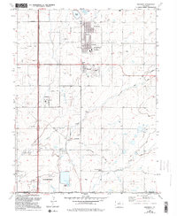
Agricultural irrigation networks and rapid suburban expansion define this landscape in the northern Front Range corridor. The Tri-Towns of Frederick, Dacono, and Firestone serve as the focal point, showing a complex transition from historic coal mining settlements to modern residential centers. These communities are interwoven with a dense system of water management features, including the Coal Ridge Ditch, Boulder and Weld County Ditch, and Stanley Ditch, which reflect the region's deep reliance on ditch systems for prairie cultivation.
Find a feature on this map
54 named features on this map. Tap any name to fly to it.
Don’t see what you’re looking for? This feature index may not catch every label — zoom into the map to look around manually.
Map Details
Editions of this 2022 Frederick Map
This is the sole edition of this map. No revisions or reprints were ever made.