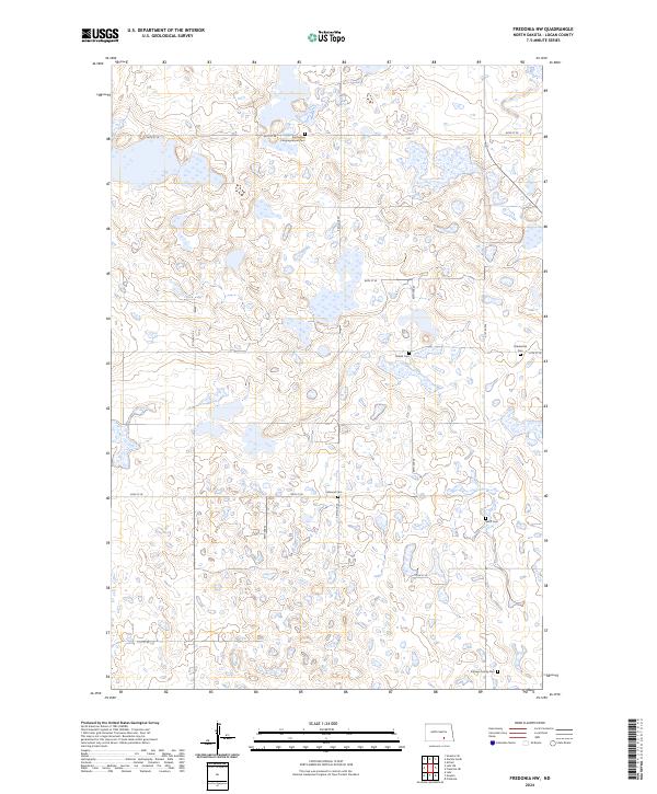
2024 Map of Fredonia NW
USGS Topo · Published 2024About this map
Glacial prairie potholes and extensive wetlands dominate this section of Logan County, characterized by a complex network of marshes and basins protected within the Logan County Waterfowl Production Area. The landscape is a study in early twentieth-century land division, where a grid of section-line roads like 64th St SE and 57th Ave SE crisscrosses the terrain, navigating around the numerous water bodies. For those researching the region's heritage, the map is remarkably dense with pioneer-era burial grounds. These small, scattered sites include the Emmanuel Congregational Cem, Finnish Cem, and the Eslinger Family Cem, each marking the legacy of the homesteading families and ethnic communities who settled these plains. Other family landmarks like the Wolff Cem, Labrenz Cem, and Friedenthal Cem reflect a pattern of rural settlement where local cemeteries often served as the primary remaining markers of early community clusters.
Find a feature on this map
23 named features on this map. Tap any name to fly to it.
Don’t see what you’re looking for? This feature index may not catch every label — zoom into the map to look around manually.
Map Details
Editions of this 2024 Fredonia NW Map
This is the sole edition of this map. No revisions or reprints were ever made.
Other maps of this area

1953 · Jamestown
USGS Topo · 1:250,000

1956 · Jamestown
USGS Topo · 1:250,000

1982 · Fredonia NW
USGS Topo · 1:24,000

1982 · Guyson
USGS Topo · 1:24,000

1982 · Fredonia
USGS Topo · 1:24,000

1982 · Lehr NE
USGS Topo · 1:24,000

1982 · Fredonia NE
USGS Topo · 1:24,000
1982 · Lehr
USGS Topo · 1:24,000

1983 · Alfred
USGS Topo · 1:24,000

1983 · Streeter SE
USGS Topo · 1:24,000