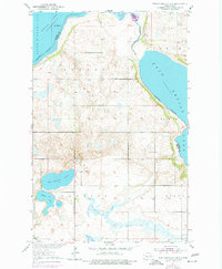
1951 Map of Free Peoples Lake
USGS Topo · Published 1977About this map
South Minnewaukan Lake and East Devils Lake dominate the northern and eastern portions of this prairie landscape, defined by the fluctuating water levels of the Devils Lake basin. The map illustrates a rural settlement pattern centered on the namesake Free Peoples Lake and the Free Peoples Sch. These features, along with the nearby Elbow Lake, suggest a community deeply tied to the local hydrology.
Find a feature on this map
11 named features on this map. Tap any name to fly to it.
Don’t see what you’re looking for? This feature index may not catch every label — zoom into the map to look around manually.
Map Details
Editions of this 1951 Free Peoples Lake Map
2 editions found

Other maps of this area

1928 · Tokio
USGS Topo · 1:62,500

1930 · Hamar
USGS Topo · 1:62,500

1931 · Tokio
USGS Topo · 1:62,500

1931 · Devils Lake
USGS Topo · 1:62,500

1950 · Tokio
USGS Topo · 1:24,000

1950 · Devils Lake
USGS Topo · 1:62,500

1950 · Devils Lake Mountain
USGS Topo · 1:24,000

1951 · Crary
USGS Topo · 1:24,000

1951 · Devils Lake Mountain
USGS Topo · 1:24,000

1951 · Devils Lake
USGS Topo · 1:24,000