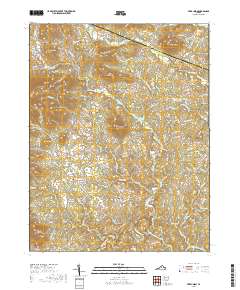
2019 Map of Free Union
USGS Topo · Published 2019About this map
Free Union anchors the southern portion of this landscape where the Mechums River and Moormans River converge to form the South Fork Rivanna River. The area is characterized by significant topographic relief, with prominent peaks like Harris Mtn, Green Mtn, and Fox Mtn rising above the creek valleys. This modern survey captures the rural settlement patterns along the Greene and Albemarle county line, preserving the locations of numerous historic family and community burial grounds, including Prize Hill Cem, Gentry Cem, and Thompson Cem. The hydrology of the region is well-defined by a dense network of waterways such as Buck Mountain Cr, Lynch River, and Elk Run, which have historically shaped the road networks and small communities like Nortonsville and Boonesville in the north.
Find a feature on this map
111 named features on this map. Tap any name to fly to it.
Don’t see what you’re looking for? This feature index may not catch every label — zoom into the map to look around manually.
Map Details
Editions of this 2019 Free Union Map
This is the sole edition of this map. No revisions or reprints were ever made.
Other maps of this area

1892 · Gordonsville
USGS Topo · 1:125,000

1892 · Harrisonburg
USGS Topo · 1:125,000

1930 · Madison
USGS Topo · 1:48,000

1931 · University
USGS Topo · 1:62,500

1933 · Madison
USGS Topo · 1:62,500

1935 · Charlottesville
USGS Topo · 1:62,500

1935 · University
USGS Topo · 1:62,500

1937 · Elkton
USGS Topo · 1:62,500

1939 · Charlottesville
USGS Topo · 1:62,500

1949 · Charlottesville
USGS Topo · 1:250,000