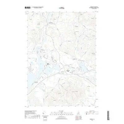
2018 Map of Freedom
USGS Topo · Published 2018About this map
Ossipee Lake serves as the dominant geographical feature of this region, its waters divided into distinct basins such as Broad Bay, Leavitt Bay, and Berry Bay. The landscape is a complex network of waterways, where the Ossipee River flows eastward from the lake toward Effingham Falls. This 2018 survey reveals a topography defined by significant elevations, including Green Mtn and Cragged Mtn, which frame the settled valleys. Small communities like Freedom and East Madison are connected by a winding network of roads that follow the contours of the terrain. The presence of Lakeview Cem near Loon Lake and established settlements such as Ossipee Lake Shores and Long Sands indicates the long-standing residential and seasonal character of these lakeside corridors.
Find a feature on this map
126 named features on this map. Tap any name to fly to it.
Don’t see what you’re looking for? This feature index may not catch every label — zoom into the map to look around manually.
Map Details
Editions of this 2018 Freedom Map
This is the sole edition of this map. No revisions or reprints were ever made.
Other maps of this area

1891 · Newfield
USGS Topo · 1:62,500

1893 · Newfield
USGS Topo · 1:62,500

1910 · Kezar Falls
USGS Topo · 1:48,000

1911 · Kezar Falls
USGS Topo · 1:62,500

1928 · Wolfeboro
USGS Topo · 1:62,500

1930 · Ossipee Lake
USGS Topo · 1:62,500

1933 · Newfield
USGS Topo · 1:48,000

1937 · Newfield
USGS Topo · 1:62,500

1942 · Newfield
USGS Topo · 1:62,500

1944 · Newfield
USGS Topo · 1:62,500