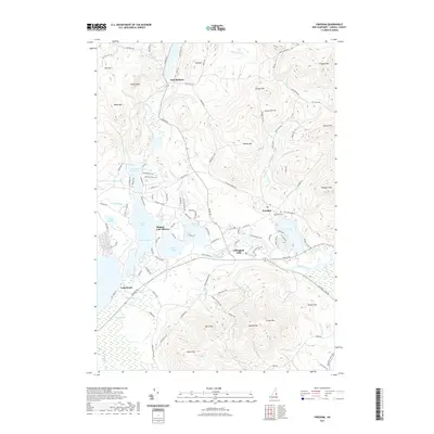
2021 Map of Freedom
USGS Topo · Published 2021About this map
Freedom and Effingham Falls anchor this Carroll County landscape, where the Ossipee River flows through a complex network of bays and inlets. The map illustrates a contemporary pattern of lakeside living and seasonal recreation, particularly concentrated at Ossipee Lake Shores and Long Sands. To the north, Purity Lake and the settlement of East Madison are surrounded by a rugged upland of named peaks, including Blazo Mtn and Cragged Mtn. The terrain is marked by significant topographical variation, rising from the wetlands of Heath Pond to the prominence of Green Mtn and Hanson Top. Local genealogy and historical continuity are represented by features like Lakeview Cem near the village center of Freedom. This modern record details the intricate shoreline of Broad Bay, Leavitt Bay, and Berry Bay, reflecting how water bodies have shaped development in this New Hampshire corridor.
Find a feature on this map
125 named features on this map. Tap any name to fly to it.
Don’t see what you’re looking for? This feature index may not catch every label — zoom into the map to look around manually.
Map Details
Editions of this 2021 Freedom Map
This is the sole edition of this map. No revisions or reprints were ever made.
Other maps of this area

1891 · Newfield
USGS Topo · 1:62,500

1893 · Newfield
USGS Topo · 1:62,500

1910 · Kezar Falls
USGS Topo · 1:48,000

1911 · Kezar Falls
USGS Topo · 1:62,500

1928 · Wolfeboro
USGS Topo · 1:62,500

1930 · Ossipee Lake
USGS Topo · 1:62,500

1933 · Newfield
USGS Topo · 1:48,000

1937 · Newfield
USGS Topo · 1:62,500

1942 · Newfield
USGS Topo · 1:62,500

1944 · Newfield
USGS Topo · 1:62,500