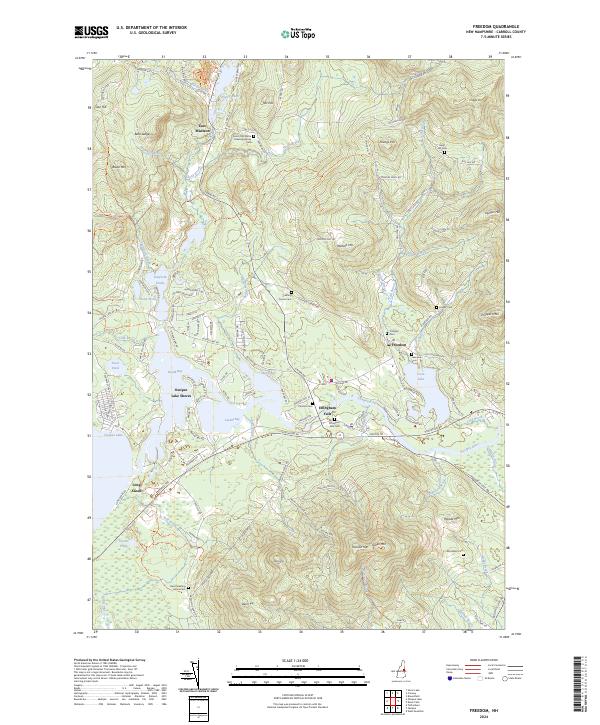
2024 Map of Freedom
USGS Topo · Published 2024About this map
Green Mtn and Woods Mtn dominate the southern landscape of this Carroll County survey, where the Ossipee River drains the vast waters of Ossipee Lake. The settlement pattern follows the intricate shoreline of Broad Bay, Berry Bay, and Leavitt Bay, creating a community deeply tied to the waterfront at Ossipee Lake Shores. Genealogy researchers will find significant value in the numerous burial sites and historic landmarks, including the Eaton Old White Meeting House near East Madison and the Davis Meeting House Cem to the south. The transition from the high elevations of Blazo Mtn and Cragged Mtn down to the low-lying Heath Pond and Danforth Ponds illustrates the complex drainage basin that feeds the regional river systems.
Find a feature on this map
136 named features on this map. Tap any name to fly to it.
Don’t see what you’re looking for? This feature index may not catch every label — zoom into the map to look around manually.
Map Details
Editions of this 2024 Freedom Map
This is the sole edition of this map. No revisions or reprints were ever made.
Other maps of this area

1891 · Newfield
USGS Topo · 1:62,500

1893 · Newfield
USGS Topo · 1:62,500

1910 · Kezar Falls
USGS Topo · 1:48,000

1911 · Kezar Falls
USGS Topo · 1:62,500

1928 · Wolfeboro
USGS Topo · 1:62,500

1930 · Ossipee Lake
USGS Topo · 1:62,500

1933 · Newfield
USGS Topo · 1:48,000

1937 · Newfield
USGS Topo · 1:62,500

1942 · Newfield
USGS Topo · 1:62,500

1944 · Newfield
USGS Topo · 1:62,500