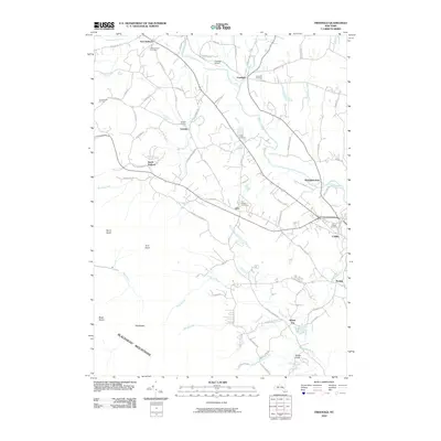
2010 Map of Freehold
USGS Topo · Published 2010About this map
Catskill Creek and its many tributaries, such as Basic Creek and Platte Kill, carve through this section of Greene County, defining the drainage patterns south toward the Blackhead Mountains. The landscape in 2010 shows a high density of ancestral sites for researchers, including the Cairo Village Cemetery and Snyder Cemetery, which sit alongside historic crossroads settlements like Freehold, Acra, and Sunside. The map captures a mix of traditional valley agriculture and high-relief terrain, with peaks like Black Dome and Acra Point rising above the creek beds. Human activity is evidenced by small aviation infrastructure at Freehold Airport and specialized rural enterprises such as Armstrongs Elk Farm. The layout of the road network, including the Old S Durham Hwy, reflects the early settlement corridors that followed the water gaps into the higher elevations.
Find a feature on this map
84 named features on this map. Tap any name to fly to it.
Don’t see what you’re looking for? This feature index may not catch every label — zoom into the map to look around manually.
Map Details
Editions of this 2010 Freehold Map
This is the sole edition of this map. No revisions or reprints were ever made.
Other maps of this area

1892 · Kaaterskill
USGS Topo · 1:62,500

1893 · Kaaterskill
USGS Topo · 1:62,500

1893 · Coxsackie
USGS Topo · 1:62,500

1893 · Durham
USGS Topo · 1:62,500

1894 · Coxsackie
USGS Topo · 1:62,500

1894 · Kaaterskill
USGS Topo · 1:62,500

1894 · Durham
USGS Topo · 1:62,500

1895 · Catskill
USGS Topo · 1:62,500

1899 · Kaaterskill
USGS Topo · 1:62,500

1903 · Kaaterskill
USGS Topo · 1:62,500