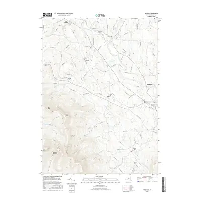
2016 Map of Freehold
USGS Topo · Published 2016About this map
Catskill Creek and its many tributaries, including Platte Kill and Shingle Kill, carve through this landscape at the foot of the Blackhead Mountains. The map reflects a region of small, established hamlets such as Freehold, Acra, and Cairo, where the clustering of local cemeteries like Cairo Village Cem and East Durham Cem indicates deep-rooted family ties to the land. Settlement patterns follow the winding course of the creeks and the secondary roads that connect them, while the southern portion of the map rises sharply toward Black Dome and the high ridges of the Black Dome Valley. The presence of the Freehold Airport and scattered small reservoirs like Rockefeller Lake suggest a mix of local utility and private land use in this Greene County corridor.
Find a feature on this map
110 named features on this map. Tap any name to fly to it.
Don’t see what you’re looking for? This feature index may not catch every label — zoom into the map to look around manually.
Map Details
Editions of this 2016 Freehold Map
This is the sole edition of this map. No revisions or reprints were ever made.
Other maps of this area

1892 · Kaaterskill
USGS Topo · 1:62,500

1893 · Kaaterskill
USGS Topo · 1:62,500

1893 · Coxsackie
USGS Topo · 1:62,500

1893 · Durham
USGS Topo · 1:62,500

1894 · Coxsackie
USGS Topo · 1:62,500

1894 · Kaaterskill
USGS Topo · 1:62,500

1894 · Durham
USGS Topo · 1:62,500

1895 · Catskill
USGS Topo · 1:62,500

1899 · Kaaterskill
USGS Topo · 1:62,500

1903 · Kaaterskill
USGS Topo · 1:62,500