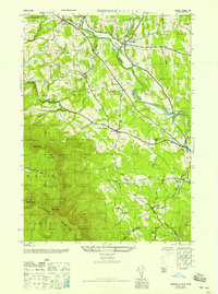
1945 Map of Freehold
USGS Topo · Published 1946About this map
Catskill Creek and its many tributaries, including Basic Creek and Bowery Creek, carve a complex drainage pattern through this section of Greene County. The northern reaches are defined by a network of small hamlets and agricultural crossings such as Freehold and East Durham, while the southern half of the sheet climbs sharply into the high peaks of the Blackhead Mountains. This elevation shift is dominated by the Catskill State Park boundary, encompassing prominent summits like Black Dome and Burnt Knob.
Find a feature on this map
37 named features on this map. Tap any name to fly to it.
Don’t see what you’re looking for? This feature index may not catch every label — zoom into the map to look around manually.
Map Details
Editions of this 1945 Freehold Map
This is the sole edition of this map. No revisions or reprints were ever made.
Other maps of this area

1892 · Kaaterskill
USGS Topo · 1:62,500

1893 · Kaaterskill
USGS Topo · 1:62,500

1893 · Coxsackie
USGS Topo · 1:62,500

1893 · Durham
USGS Topo · 1:62,500

1894 · Coxsackie
USGS Topo · 1:62,500

1894 · Kaaterskill
USGS Topo · 1:62,500

1894 · Durham
USGS Topo · 1:62,500

1895 · Catskill
USGS Topo · 1:62,500

1899 · Kaaterskill
USGS Topo · 1:62,500

1903 · Kaaterskill
USGS Topo · 1:62,500