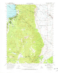
1956 Map of Freel Peak
USGS Topo · Published 1967About this map
Freel Peak towers over a landscape defined by the high-altitude divide between the Lake Tahoe basin and the agricultural expanses of the Carson Valley. During the mid-1950s, the south shore of the lake was undergoing a visible transformation into a year-round recreation hub, evidenced by the Heavenly Valley Ski Lodge and burgeoning settlements like Stateline, Bijou, and Al Tahoe. This era captures the transition from older sites like the Sierra House (Site) to modern facilities such as the 4 H Club Camp. To the east, the map reveals an intricate network of irrigation ditches, including the Diamond Ditch and Millich Ditch, supporting the ranching communities of Minden, Gardnerville, and Woodfords. The rugged interior is crossed by historic routes like the Snowshoe Thompson and Von Schmidt Line, marking both the physical challenges of the terrain and the legal complexities of the California-Nevada border.
Find a feature on this map
172 named features on this map. Tap any name to fly to it.
Don’t see what you’re looking for? This feature index may not catch every label — zoom into the map to look around manually.
Map Details
Editions of this 1956 Freel Peak Map
3 editions found

Other maps of this area

1889 · Pyramid Peak
USGS Topo · 1:125,000

1889 · Markleeville
USGS Topo · 1:125,000

1891 · Carson
USGS Topo · 1:125,000

1891 · Markleeville
USGS Topo · 1:125,000

1891 · Truckee
USGS Topo · 1:125,000

1891 · Pyramid Peak
USGS Topo · 1:125,000

1893 · Carson
USGS Topo · 1:125,000

1893 · Markleeville
USGS Topo · 1:125,000

1893 · Truckee
USGS Topo · 1:125,000

1895 · Pyramid Peak
USGS Topo · 1:125,000