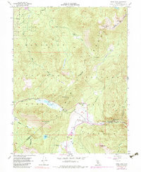
1955 Map of Freel Peak
USGS Topo · Published 1983About this map
Freel Peak towers over the high country of the Sierra Nevada, marking the rugged boundary where Eldorado National Forest meets the Toiyabe National Forest. The landscape is defined by its dramatic relief, spanning from the alpine waters of Star Lake down to the meadows of the West Fork Carson River. Historic routes and seasonal encampments populate the valleys, notably at Dangberg Camp and Sorensens, reflecting the area's long-standing use for summer grazing and mountain passage.
Find a feature on this map
32 named features on this map. Tap any name to fly to it.
Don’t see what you’re looking for? This feature index may not catch every label — zoom into the map to look around manually.
Map Details
Editions of this 1955 Freel Peak Map
4 editions found
Other maps of this area

1889 · Pyramid Peak
USGS Topo · 1:125,000

1889 · Markleeville
USGS Topo · 1:125,000

1891 · Markleeville
USGS Topo · 1:125,000

1891 · Pyramid Peak
USGS Topo · 1:125,000

1893 · Markleeville
USGS Topo · 1:125,000

1895 · Pyramid Peak
USGS Topo · 1:125,000

1896 · Pyramid Peak
USGS Topo · 1:125,000

1947 · Sacramento
USGS Topo · 1:250,000

1948 · Walker Lake
USGS Topo · 1:250,000

1948 · Sacramento
USGS Topo · 1:250,000