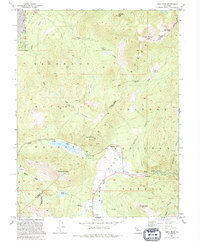
1992 Map of Freel Peak
USGS Topo · Published 1994About this map
Freel Peak rises as the dominant landmark of this high-altitude region along the El Dorado and Alpine County line. The landscape is defined by the convergence of the Toiyabe National Forest and Eldorado National Forest, where the mountain hydrology feeds Trout Creek, Saxon Creek, and the West Fork Carson River. Evidence of mountain transit and seasonal settlement is scattered throughout the drainages, including Dangberg Camp, Fountain Place, and the roadside stop at Sorensens. Historic travel routes are etched into the topography, most notably the Pioneer Trail and the crossing at Luther Pass. In the high basins, water bodies like Star Lake and Grass Lake sit near steep slopes marked by a legacy of resource extraction, indicated by a Shaft near the upper reaches of Saxon Creek.
Find a feature on this map
31 named features on this map. Tap any name to fly to it.
Don’t see what you’re looking for? This feature index may not catch every label — zoom into the map to look around manually.
Map Details
Editions of this 1992 Freel Peak Map
2 editions found
Other maps of this area

1889 · Pyramid Peak
USGS Topo · 1:125,000

1889 · Markleeville
USGS Topo · 1:125,000

1891 · Markleeville
USGS Topo · 1:125,000

1891 · Pyramid Peak
USGS Topo · 1:125,000

1893 · Markleeville
USGS Topo · 1:125,000

1895 · Pyramid Peak
USGS Topo · 1:125,000

1896 · Pyramid Peak
USGS Topo · 1:125,000

1947 · Sacramento
USGS Topo · 1:250,000

1948 · Walker Lake
USGS Topo · 1:250,000

1948 · Sacramento
USGS Topo · 1:250,000