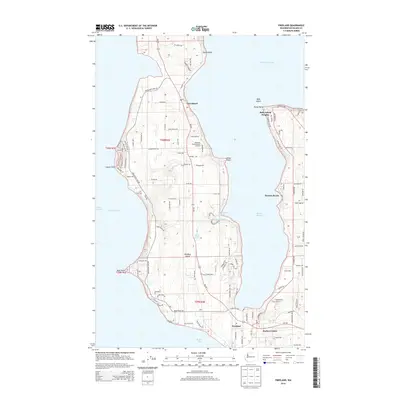
2014 Map of Freeland
USGS Topo · Published 2014About this map
Whidbey Island dominates this 2014 survey, showcasing a complex landscape of coastal settlements and inland waters between Admiralty Inlet and Saratoga Passage. The map details the residential expansion of the early 21st century in communities like Freeland, Harbor Center, and Greenbank. Natural features are prominent throughout the island interior, including Chase Lake and the Meerkerk Rhododendron Gardens, while the coastline is marked by distinctive formations such as Lagoon Point, Bush Point, and Pratts Bluff. The intricate network of bays is clearly defined, with Holmes Harbor cutting deep into the landmass, creating a sheltered environment for Honeymoon Bay and the small enclave at Baby Island Heights. This era of the island's history is characterized by a dense grid of local roads and state routes, like Wa-525, that link these diverse maritime and rural neighborhoods.
Find a feature on this map
115 named features on this map. Tap any name to fly to it.
Don’t see what you’re looking for? This feature index may not catch every label — zoom into the map to look around manually.
Map Details
Editions of this 2014 Freeland Map
This is the sole edition of this map. No revisions or reprints were ever made.
Other maps of this area

1895 · Snohomish
USGS Topo · 1:125,000

1897 · Seattle
USGS Topo · 1:125,000

1911 · Mount Vernon
USGS Topo · 1:125,000

1937 · Port Gamble
USGS Topo · 1:62,500

1939 · Coupeville
USGS Topo · 1:62,500

1940 · Port Gamble
USGS Topo · 1:62,500

1942 · Edmonds
USGS Topo · 1:62,500

1943 · Stanwood
USGS Topo · 1:62,500

1953 · Hansville
USGS Topo · 1:24,000

1953 · Coupeville
USGS Topo · 1:24,000