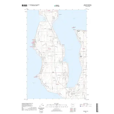
2020 Map of Freeland
USGS Topo · Published 2020About this map
Whidbey Island occupies the center of this 2020 survey, where the narrow waist of the land is nearly pinched off by the deep indentation of Holmes Harbor. This topographic study details the residential and recreational development along the shoreline, from the community of Greenbank in the north to Freeland and Harbor Center in the south. The island's geography is defined by its diverse coastal features, including the prominent Bush Point on the west and Rocky Point on the east.
Find a feature on this map
121 named features on this map. Tap any name to fly to it.
Don’t see what you’re looking for? This feature index may not catch every label — zoom into the map to look around manually.
Map Details
Editions of this 2020 Freeland Map
This is the sole edition of this map. No revisions or reprints were ever made.
Other maps of this area

1895 · Snohomish
USGS Topo · 1:125,000

1897 · Seattle
USGS Topo · 1:125,000

1911 · Mount Vernon
USGS Topo · 1:125,000

1937 · Port Gamble
USGS Topo · 1:62,500

1939 · Coupeville
USGS Topo · 1:62,500

1940 · Port Gamble
USGS Topo · 1:62,500

1942 · Edmonds
USGS Topo · 1:62,500

1943 · Stanwood
USGS Topo · 1:62,500

1953 · Hansville
USGS Topo · 1:24,000

1953 · Coupeville
USGS Topo · 1:24,000