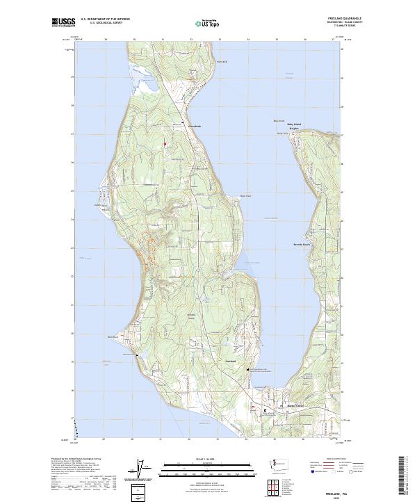
2023 Map of Freeland
USGS Topo · Published 2023About this map
Whidbey Island is defined by its deep inlets and maritime orientation, as shown in this detailed 2023 survey. The central portion of the island is deeply carved by Holmes Harbor, which separates the main landmass from the Baby Island Heights peninsula. Settlement is concentrated along the shorelines in communities such as Freeland, Greenbank, and Harbor Center, reflecting a landscape dominated by residential growth and coastal access.
Find a feature on this map
122 named features on this map. Tap any name to fly to it.
Don’t see what you’re looking for? This feature index may not catch every label — zoom into the map to look around manually.
Map Details
Editions of this 2023 Freeland Map
This is the sole edition of this map. No revisions or reprints were ever made.
Other maps of this area

1895 · Snohomish
USGS Topo · 1:125,000

1897 · Seattle
USGS Topo · 1:125,000

1911 · Mount Vernon
USGS Topo · 1:125,000

1937 · Port Gamble
USGS Topo · 1:62,500

1939 · Coupeville
USGS Topo · 1:62,500

1940 · Port Gamble
USGS Topo · 1:62,500

1942 · Edmonds
USGS Topo · 1:62,500

1943 · Stanwood
USGS Topo · 1:62,500

1953 · Hansville
USGS Topo · 1:24,000

1953 · Coupeville
USGS Topo · 1:24,000