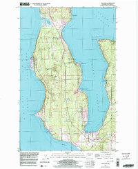
1998 Map of Freeland
USGS Topo · Published 2003About this map
Central Whidbey Island is defined by its deep coastal indentations and maritime infrastructure in this late-twentieth-century study. The landscape is anchored by significant military and conservation tracts, notably the Lake Hancock Target Range and the Naval Reservation Bdy surrounding Lake Hancock. Residential pockets like Greenbank and Baby Island Heights contrast with the largely rural and wooded interior, while a Cem and Windmill offer points of interest for local history researchers.
Find a feature on this map
29 named features on this map. Tap any name to fly to it.
Don’t see what you’re looking for? This feature index may not catch every label — zoom into the map to look around manually.
Map Details
Editions of this 1998 Freeland Map
This is the sole edition of this map. No revisions or reprints were ever made.
Other maps of this area

1895 · Snohomish
USGS Topo · 1:125,000

1897 · Seattle
USGS Topo · 1:125,000

1911 · Mount Vernon
USGS Topo · 1:125,000

1937 · Port Gamble
USGS Topo · 1:62,500

1939 · Coupeville
USGS Topo · 1:62,500

1940 · Port Gamble
USGS Topo · 1:62,500

1942 · Edmonds
USGS Topo · 1:62,500

1943 · Stanwood
USGS Topo · 1:62,500

1953 · Hansville
USGS Topo · 1:24,000

1953 · Coupeville
USGS Topo · 1:24,000